He replies: Simcity -or more specifically the Simcity I designed Sheldonopolis.
Rajesh: OK you are in Sheldonopolis
Sheldon: Where exactly? Sheldon square, Sheldon Towers, Sheldon Stadium, home of the fighting Sheldons….”
I wonder what would happen if we indeed stepped into a Simcity creation? Here you go:
For me visiting Brasília, the capital of Brazil a city planned and built in the late 1950s, is akin to visiting a Simcity creation brought to life. Wide avenues, treescaped vistas, monumental buildings, extensive parklands and strict height restrictions, one could almost see the Red, Blue and Yellow coloured squares of the Simcity game board.
You know what? I like this real “Sim City“! Although I want to see more added to the City of Brasília (more on that later)
Today’s blog post is largely about the design and construction of the city – and my reactions to it- good and bad. Check out other posts on my Apppraisal of Brasília, and on being a tourist there. I also dedicate a post on the very famous Oscar Niemeyer key buildings. Today’s will probably be a long post as I am using this to understand this city -theres a lot to say. If you are interested in city planning or very different tourist locales enjoy!
Design Competition for Brasília
To choose the design for the new capital, a competition was held in 1957. Interestingly, the city was already under construction. 26 competitors submitted 41 projects. There were four shortlisted entries:
1. The winning entry by Lucio Costa which aimed for a population of 500 000 (see more below)
2. A fairly bland governmental city by Milman, Rocha and Gonçalves- population 673 000
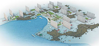
3. Rino Levi proposed a city with 16 super towers (above) in six sectors. The 75 to 80 story towers would have accommodated 288,000 people out of a total city population of 500 000! Each tower would have been a kilometre or less from the downtown, so the intention was most people would walk “on a larger scale than in other cities -increase the contact among the population“
 |
| The Maurico Plan |
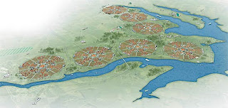
4. Marcelo and Roberto Mauricio suggested my personal favourite: -Seven to 14 circle-shaped “urban” units each with a 2km diameter was planned with 72 000 people. Each unity would be “a complete city” where people would live next to their working place, so they would mostly walk. Total city population: 630,000 to 1,260,000. Their failure: to actually include space for the National Capital buildings!
Costa’s Brasilia – the one that was adopted
Basic Structure of the City
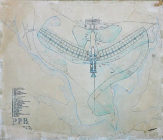
From the sky the plan looks like a bird-many have suggested it was designed like an aeroplane-something Costas refuted: “Nonsense…That is ridiculous. That’s an acceptable analogy, but it would be total imbecility to make a city in the shape of an airplane.”
The wings of the Bird run North-South (North is to the right). These were designed to be the residential districts of the city. The bulk of the residences were built along a radial arterial road with fast central lanes and side lanes for local traffic
 |
| The original crossing of the Axes in 1958 |
The East West axis (the head and body of the bird) is known as the Monumental Axis. East is where the “tail of then bird would be” Along this axis are the government buildings and the cultural, entertainment and sporting precincts.
Centre of the City
The city consists of two main axes crossing at right-angles. At the intersection of the two axes the bus station was placed and around the the intersection were the banking, shopping, hotel and commercial districts and the entertainment center of the city, with cinemas, restaurants, etc. This means everything in the hotel sector is a hotel and everything in the banking sector is a bank!
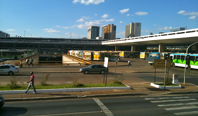 |
| Center of the Axis Crossing facing north- the bus stn- the north south road is in the tunnel/underpass in centre of pic. The towers of the banking sector can be seen |
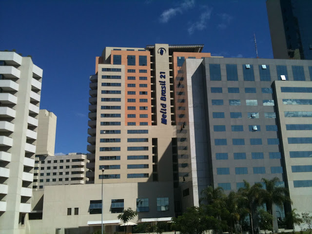 |
| Hotel Sector South- My hotel Melia Brasil 21 -which was a fantastic hotel |
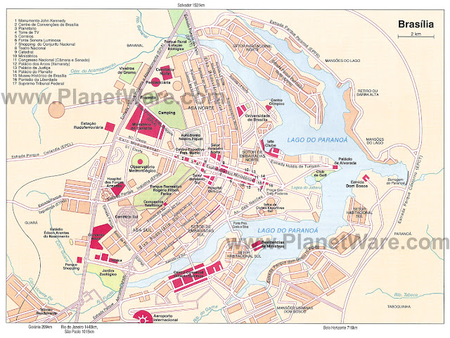 |
| Plan of Brasilia showing the lake, the streets and key structures.The wings run North to South. The Monumental Axis, the Birds head, body and tail runs East to West (in this case right to left) |
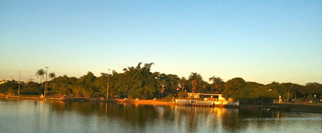 |
| City Park |
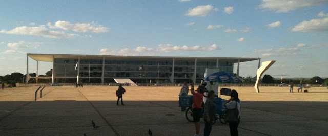
At the other end, the Eastern end (Bird tail) is a vast square called Three Powers Square around which are arranged the three key power centres of Brazil: the Supreme Federal Court, (National Congress and President Palace (Palácio do Planalto). More on the buildings Thursday next week.
For the next kilometre from the Ministries to the Central Bus station are the Cathedral, museums, library, planetarium all in a park like setting.
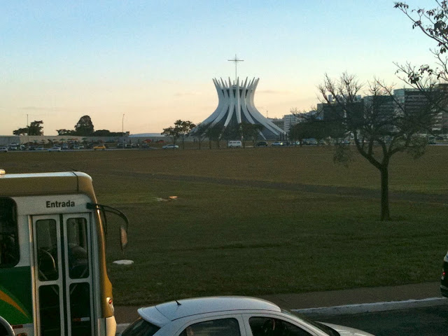 |
| The Cathedral In Brasilia. Six lanes of traffic, a very wide median strip and six more lanes of traffic separate it from me in this picture. |
Transport
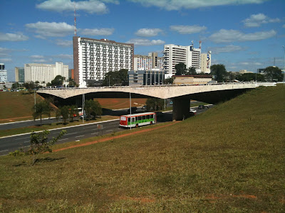
Costas was determined to avoid the mistakes made in other cities. The road system was designed to reduce intersections with flyovers and cloverleafs and pedestrian tunnels. Private car ownership was seen as the way of the future so the road system was designed to make driving a pleasure.
Costas envisaged taxis and buses for public transport even specifying the colour of the taxis (grey with green stripe) and the uniforms of the drivers.
Main Residential Superblocks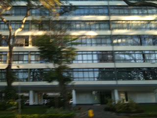 Large residential blocks were set in double or single line along both sides of the residential North-South highway axis. Each block was surrounded by bands of greenery planted with trees. These blocks were grouped into four to create “superblocks”. All residential buildings within the blocks were six stories high raised on pillars (it is claimed so mothers could call down to their children). While they were the same height level, the way the residential buildings were arranged on the blocks varied to create ground level variety
The local Church and secondary schools were placed in the middle of the superblocks. Shops and cinemas were included in the Superblock structure. All cars were parked at the front and residents would walk between schools, shops, church and residential buildings.
The superblocks were known by numbers, the residential buildings by letters in relation to the entrance to the superblock. An address would read, for example, N-S3-L, apt. 201. Costas believed that these superblocks would eliminate “undesirable class distinctions”
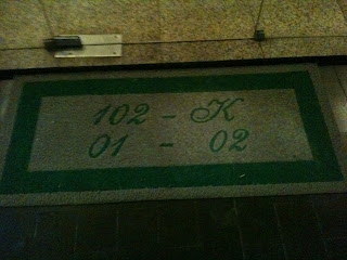 |
| Entry map of a block of flats in a Super Block |
Other Housing
Isolated residential districts surrounded by trees and open countryside were sold for single family homes The lakefront was not to be developed for residences with the exception of the President’s house, to preserve the lake’s beauty
Brasilia Issues
 |
| A new town |
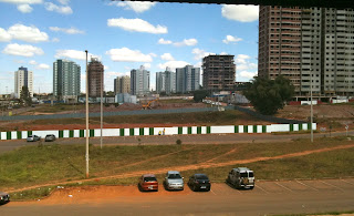
- The construction of a brand new city 200km from the nearest rail head with new highways built to link it to all parts of Brazil, almost bankrupted Brazil hence why some projects were not finished for years and some never completed
- The army took control of Brazil in 1964, four years after the new capital had opened. Many infrastructure projects came to an end as the country slid into economic malaise.
- Costas wanted no squatters or unplanned developments. This meant for example, the builders who came to build Brasilia were not allowed to live in the city so stayed in construction camps which grew into satellite towns such as Gama, Ceilândia, Taguatinga, Núcleo Bandeirante, Sobradinho, and Planaltina.
- All of the new towns, with the exception of Gama and Sobradinho were not planned.
- The city population today is about 2.5 million (3.6 million in the metropolitan area) instead of the 0.5 million maximum originally envisaged
- There is a debate as to whether Brasília consists of the whole metro area with the unplanned new towns or the original nucleus
- the original plan was modified eg the original central pedestrian precinct with a European style cafe and market culture was never built
- in a country with very low car ownership, building a car oriented city may not have been a good thing
- In 1987 UNESCO put Brasília’s Pilot Plan on its official list of World Heritage sites. The disadvantage of this is it has turned the city into a museum. Nothing of the original plan can be altered
Criticisms of Brasília
Critics of the City are vicious:
- The greatest criticism of Brasília is that it is a culturally inappropriate city being based upon European ideas, not Brazilian ones
- it is designed for automobiles and air-conditioners, not people.
- The poor, who work in the construction and service industries, were not part of the plan for an inland capital and live in settlements up to 30 km outside the city, called ‘anti-Brasílias’.
- Holston claimed it fail to deliver on its social purpose
- “cultural wasteland”
- “lacks community”
- “the three day city” referring to the civil servants who delay arriving into Brasilia and get out as quickly as they can
- “Very spread out, painfully expensive and with little in the way of touristic sights, Brasilia doesn’t have much to offer the backpacker”
I think some critics are too harsh. Everyone who lived here that I talked to was very proud of their city. It is a city though you need to adapt to.
My Reflections
Walking here is Counter Intuitive
People often claim that Brasilia was not planned as a pedestrian city. This is not so. Pedestrian pathways were carefully constructed so that cars and Pedestrians are separated. The aim to me seems to be that people would drive or be driven to a key locale. Once there they could leave their car and walk around. The disadvantage is that if you want to walk between locales, you are frustrated.
For example. My Hotel Melia Brasil 21 is what would be a maximum ten minute walk from the Galeria Metro station in any other city. The walk however is 20-25 minutes and thats now I knew where I am going. The nature of the footpaths mean people need to know where they lead because some just seem to stop and others veer in the opposite dorcetion to your destination but veer back via some hidden passageway.
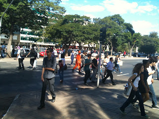
As a result, as a tourist trying to get from hotel to shopping and main monuments basically means taxis, hire cars or Exhaustion. More seriously, there are unofficial paths everywhere crossing across the vast grassed areas and deaths from people crossing the roads illegally.
I will post more on the difficulty of walking around Brasilia.
Public Transit underdeveloped in a car city
If anyone can work out the bus system, let me know
More Car Usage
The city design actively increases car usage. One friend’s apartment is 1.2km from his office. in most cities that’s an easy walk. Not for him.
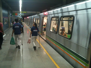
He has a metro station near hid house and one “near” his office. Again the trip would take 45 minutes to traverse to get from home to Metro and Metro to office. So consequently he drives.
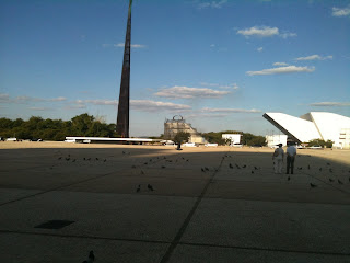
| Centre of a City-note the absence of people walking on the paths |
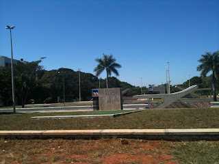 |
| Sul 102 Subway station- people? |
| One brave person crossing six lanes |
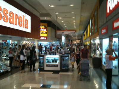
I found the streetlife in the air conditioned shopping malls which were full of Brasilianos walking freely. Straight lines, shopfronts etc
The City Park was also full of people in an environment free of cars.
However to get from City Park to the nearest shopping centre by foot is trickier than it needs to be.
In Brasilia one would start at the Hotel sector, go to the Commercial sector then to the Shopping area and then back to the hotel.
Other cities have big buildings but they are “softened” by smaller buildings grouped around them eg shop fronts that are at a height accessible to humans.
In Brasilia. the only place that seemed to allow people to capture a sense of their human size was inside the shopping malls.
- Complete the new tram line from the airport and down the busy W3 Road
- Build a light rail or Metro line down the Monumental axis to the Lake and Lago Sul residential areas
- extend the existing metro line up the north axis
- Build more metro lines and light rail lines to link so that every “New Town” is linked
- Put arrows on pavements and crossings to indicate walking routes
- Build a network of bike paths with bike parks and bike rental station
- Introduce a car sharing scheme like Zip car with cars available near every Residential Super Block
- Get a bus map published
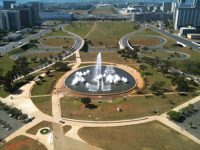
- Reduce the empty space across the city with buildings eg build buildings on the existing open air car parks in the commercial area with underground three storey car parks. The ground floors of these buildings would be shops and restaurants to create more of a streetscape
- Replace the car parks at the central bus station with a European style retail, cafe and market precinct
- Fill in gaps in the hotel districts with mixed residential/retail spaces
- Build underground retail outlets mall(s) under the Mall near the Ministry Buildings. This retail mall would be something similar to the Citylink Mall in Singapore or the Montreal underground city. Workers can eat meals, buy cell phones, books and clothes in lunch hours or after work. If an underground metro line and station was built in the Ministry area, the underground malls would link from the ministry buildings to the metro station(s)
- Have affordable quality public housing eg develop the empty superblocks area in the north of the city into affordable housing opportunities
The Football in 2014 and Olympics in 2016 will make Brazil a place to visit for people across the globe. Brasilia is not ready
- Start promoting Brasília as an attractive destination in multiple languages
- Build a high speed rail line from Brasília to Sao Paulo to link onto the new line line built to Rio for the Olympic
- Introduce a series of activities and events to use the open spaces so there is always something happening in Brasilia downtown eg architecture festival, food festivals, film festivals-create a major event every month to build life and attract tourists
- Have a Farmers Markets downtown
- Encourage Musicians in the metro stations
- Get the Guggenheim to build a new museum opposite the existing museum on the pedestrian mall and build a new wing of national museum to encourage people to move between cultural buildings. Linked to a new Museum Metro Station, one stop to Central would mean both locals and tourists could visit easily




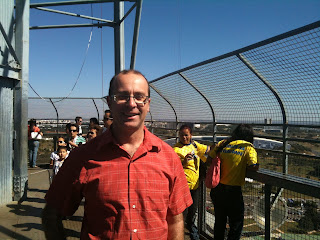
Just testing if I can comment first after not being able to before…..
Having lived in Canberra for several years, the problems I see with Brasilia pretty much echo the problems with Canberra. The arid pedestrian-free landscape certainly reminded me of Capital Hill in Canberra, which is also pedestrian-hostile.The idea of separating everything into zones doesn't really make sense. If you're a tourist, you're probably staying in a hotel; you're likely to want to go shopping, possibly do some banking, etc.How is the city for cyclists? At least Canberra is great for cyclists, with designated cycle paths throughout the city, better in the newer suburbs.
Hey anonymous..worked fine
Thanks for your comments.I saw no one cycling in Brasilia. I saw no designated cycle tracks. In my list of improvements cycle paths would be one…how to put them in is a good question. ,The city is built with a desire to maintain car flow without interruption. Cycle paths would have to go over and under roads. But you also cant spoil the visual flow of the city so that also makes it difficult.Climate wise biking in Brasilia would be hard work too.
I’m very pleased to find this web site. I want to to thank you for your time just for this wonderful read!! I definitely enjoyed every bit of it and i also have you book-marked to see new information in your blog
Wonderful blog! Do you’ve got any guidelines and hints for aspiring writers? I’m planning to start my own internet site soon but I’m slightly lost on everything. Would you suggest starting with a free platform like WordPress or go for a paid option? You can find so numerous options out there that I’m completely overwhelmed .. Any tips? Kudos!